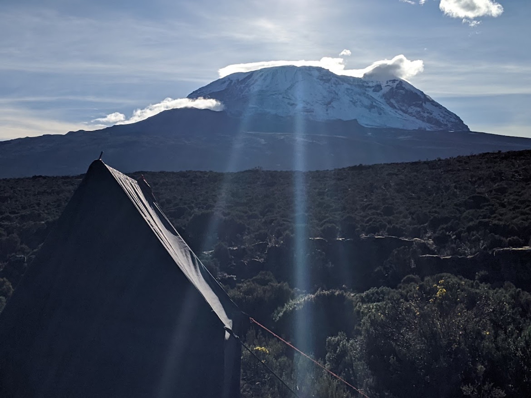
A trekking camp beneath the vast night sky on the quiet northern side of Kilimanjaro
Moderate

Rongai Route · The Wilderness Route

The only route approaching from the north, offering a wilderness feel and spectacular views of Kenya's rolling plains.

Duration
6–7 Days
Distance
65 km / 40 mi
Approach
Northern Approach
Difficulty
Moderate
From
$2,134 pp

Route overview

Tracing the mountain's north-eastern flank along the wild border country of Kenya and Tanzania, the Rongai Route reveals a face of Kilimanjaro that few trekkers ever witness. With significantly fewer climbers than Marangu or Machame, the wilderness here feels genuinely untouched. The solitude brings a greater chance of encountering wildlife — from colobus monkeys to buffalo — while the approach through traditional Chagga villages adds a rich cultural dimension. Descending via the Marangu Route means you experience the mountain from two completely different worlds.

  • The quietest, most remote approach
  • Sweeping views into the Kenyan plains
  • Genuine wildlife and Chagga village culture
  • A true 360° traverse, descending via Marangu

Itinerary — day by day

Day 1

Rongai Gate (Nale Moru) to Simba Camp — Into the Wild

The journey begins in the charming wooden village of Nale Moru, about two hours from the start (including a permit stop at Marangu). Once registered and porters are ready, the trail winds through fields of maize and potatoes before slipping into pine forest. As the climb continues through wildlife-rich woodland, the trees begin to thin — and suddenly you're standing at the edge of the moorland with the Kenyan plains stretching out before you.

Elevation
2,000 m → 2,650 m (6,560 → 8,700 ft)
Distance
6 km / 4 mi
Hiking time
3–4 hours
Habitat
Montane Forest
Meals
Lunch, Dinner
Overnight
Simba Camp
Day 2

Simba Camp to Second Cave — First Glimpse of the Giant

A steady morning climb rewards you with show-stopping views of Kibo and its glittering eastern ice fields perched on the crater rim. This is Kilimanjaro starting to reveal its true scale.

Elevation
2,650 m → 3,450 m (8,700 → 11,300 ft)
Distance
6 km / 4 mi
Hiking time
3–4 hours
Habitat
Moorland
Meals
Breakfast, Lunch, Dinner
Overnight
Second Cave Camp
Day 3

Second Cave to Kikelewa Camp — Into Mawenzi's Shadow

Cross open moorland on a narrowing path as the jagged spires of Mawenzi rise dramatically ahead. Tonight's camp sits in a sheltered valley surrounded by towering Senecios — surreal, otherworldly plants found only at this altitude.

Elevation
3,450 m → 3,600 m (11,300 → 11,800 ft)
Distance
9 km / 5 mi
Hiking time
2–3 hours
Habitat
Semi-desert
Meals
Breakfast, Lunch, Dinner
Overnight
Kikelewa Camp
Day 4

Kikelewa Camp to Mawenzi Tarn — Beneath the Spires

A short, steep climb up grassy slopes delivers some of the trek's most jaw-dropping views. As vegetation fades, you arrive at Mawenzi Tarn — dramatically tucked into a cirque right beneath Mawenzi's towering peaks. The afternoon is yours to rest or explore, and an optional extra night here is a smart move for serious acclimatization.

Elevation
3,600 m → 4,330 m (11,800 → 14,200 ft)
Distance
6 km / 4 mi
Hiking time
3–4 hours
Habitat
Semi-desert
Meals
Breakfast, Lunch, Dinner
Overnight
Mawenzi Tarn Camp
Day 5

Mawenzi Tarn to Kibo Hut — Crossing the Saddle

Today you cross the "Saddle" — a vast, lunar-like desert stretched between Mawenzi and Kibo — arriving at Kibo campsite right at the foot of the crater wall. With summit night looming, the rest of the day is reserved for rest and final preparation.

Elevation
4,330 m → 4,750 m (14,200 → 15,600 ft)
Distance
9 km / 5 mi
Hiking time
4–5 hours
Habitat
Alpine Desert
Meals
Breakfast, Lunch, Dinner
Overnight
Kibo Hut Camp
Day 6

Summit Day — Kibo to Uhuru Peak, descend to Horombo

This is it. Setting off between midnight and 2 am, you climb steep scree toward Gilman's Point on the crater rim (5,700 m / 18,700 ft) — done entirely in darkness, bitterly cold until the sun rises. From Gilman's, push on to Uhuru Peak: the highest point in Africa, and a moment that will stay with you forever. Snap your summit photo, then begin the long descent — pausing for lunch at Kibo before continuing to Horombo. Going slow ("pole pole") and staying positive will get you there.

Elevation
4,750 m → 5,895 m (15,600 → 19,340 ft), down to 3,700 m
Distance
6 km up / 15 km down
Hiking time
6–8 h up / several hours down
Habitat
Alpine Desert
Meals
Breakfast, Lunch, Dinner
Overnight
Horombo Hut Camp
Day 7

Horombo Hut to Marangu Gate, drive to Moshi — Victory Lap

The final descent winds through moorland to Mandara Hut, then deeper into lush forest toward the Marangu park gate. Lower elevations can be wet and muddy, so gaiters and poles are your friends. Your vehicle awaits at Marangu village for the ride back to Moshi (about an hour). Tip your guides and porters, then get ready to celebrate — you just conquered Africa's rooftop!

Elevation
3,700 m → 1,700 m (12,200 → 5,500 ft)
Distance
20 km / 12.5 mi
Hiking time
4–5 hours
Habitat
Forest
Meals
Breakfast
Overnight
Return to Moshi

Pricing

Prices are per person and include the full 7-day itinerary above. Travelling in a party of 8 or more? Contact us for your best rate.
Group sizePrice per person
Solo trekker$2,407
Group of 2$2,226
Group of 3$2,204
Group of 4$2,177
Group of 5$2,163
Group of 6$2,142
Group of 7$2,134

What's included

  • All Kilimanjaro National Park entry, camping & rescue fees (KINAPA)
  • Professional KINAPA-certified mountain guides
  • Full support crew — cooks and porters
  • All meals on the mountain, freshly prepared
  • Quality four-season tents and sleeping mattresses
  • Pulse-oximeter monitoring and emergency oxygen
  • Airport transfers and trailhead transport
  • International flights and Tanzania visa
  • Travel and medical insurance (mandatory)
  • Tips for guides, cooks and porters
  • Personal trekking gear and clothing
  • Drinks, snacks and personal items

Good to know

How fit do I need to be for the Rongai Route?

You don't need to be an athlete, but Kilimanjaro is a serious high-altitude trek. A few months of regular cardio plus some long day-hikes with a pack will serve you well. On the mountain the golden rule is "pole pole" — slowly, slowly.

What about altitude and acclimatization?

We build in "climb high, sleep low" days, monitor oxygen saturation twice daily with pulse oximeters, and carry emergency oxygen. Longer itineraries dramatically improve how comfortably you summit.

When is the best time to climb?

The dry seasons — January to mid-March and June to October — offer the most reliable conditions. We run treks year-round and are happy to advise on the best window for your dates.